
Major Peaks and Massifs of the Rwenzori Mountains
The Rwenzori Mountains are not one mountain. They are a rugged block of high ranges, deep gorges, glacier valleys, rocky ridges, lakes and moorland. At the centre of the park are six main massifs: Mount Stanley, Mount Speke, Mount Baker, Mount Emin, Mount Gessi and Mount Luigi di Savoia. These peaks give the Rwenzori its serious mountaineering character. When we guide you here, we are not taking you up a simple hiking hill. We are moving through a full mountain system, where weather, altitude, mud, rock, ice and endurance all shape the journey.
Mount Stanley and Margherita Peak
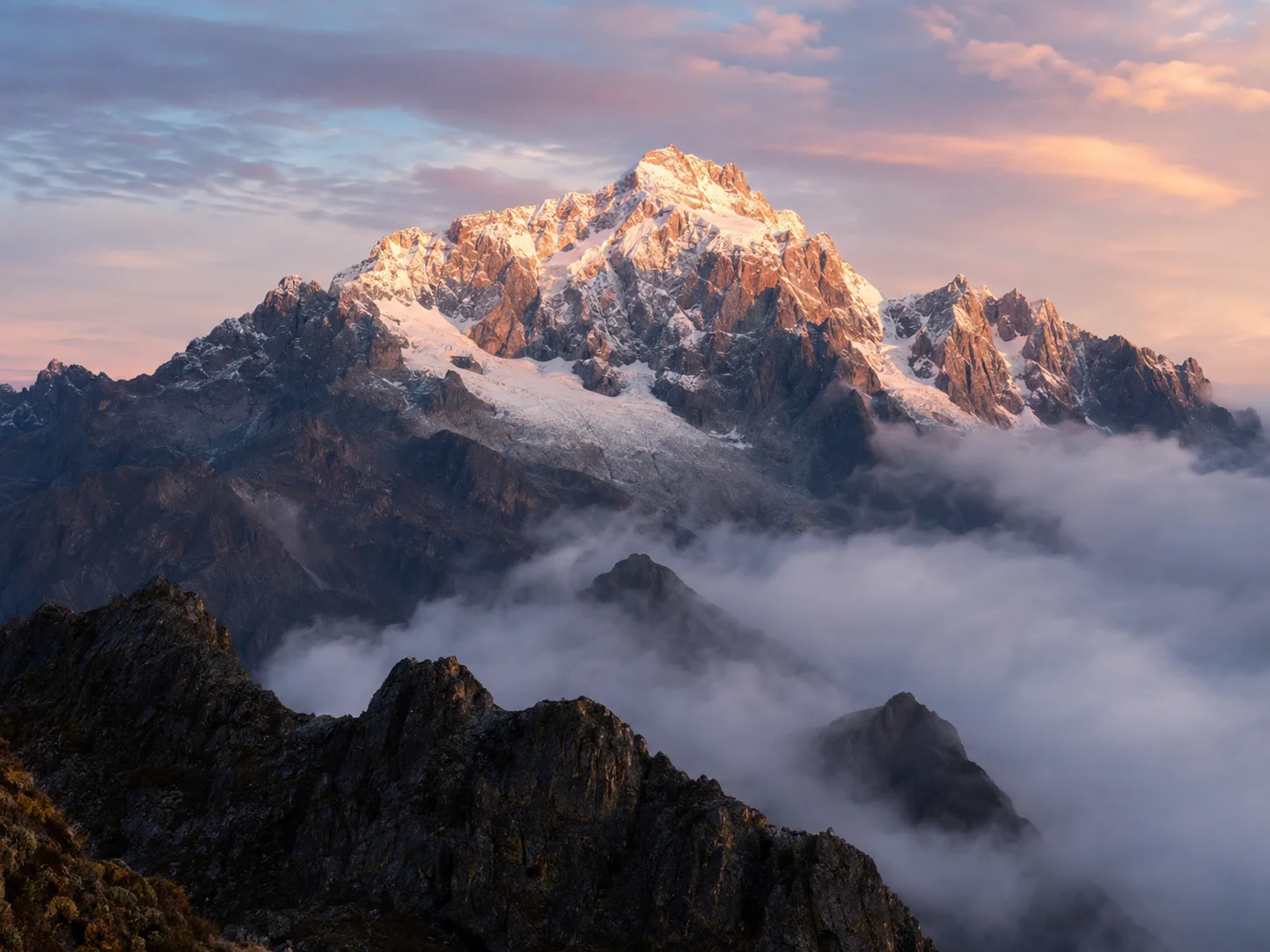
For most climbers, Mount Stanley is the main prize. Its highest summit, Margherita Peak, rises to 5,109 metres, making it Africa’s third-highest point after Kilimanjaro and Mount Kenya. Margherita Peak stands on the Uganda and DR Congo border, between Lake Albert to the north and Lake Edward to the south. It is high enough to support glaciers and permanent ice, making the final climb more technical than many people expect.
Margherita Peak
Margherita Peak was first climbed in 1906 by an expedition led by Luigi Amedeo Abruzzi and was named after Queen Margherita of Italy. Mount Stanley has several important peaks, including Margherita at 5,109 metres, Alexandra, Albert, Savoia, Elena, Great Tooth, Elizabeth, Philip, Kitasamba and Nyabubuya. When you are high in the Rwenzori, these names stop feeling like map labels. They become the ridges, snow lines, glaciers and rock faces rising above your trail.
Mount Speke
Mount Speke is the second-highest mountain in the Rwenzori range, standing at 4,890 metres (16,040 feet). It forms part of the famous triangle with Mount Stanley and Mount Baker around the upper Bujuku Valley. This is one of the most impressive mountain settings in Uganda. The trail moves through boggy valleys, giant vegetation and open views of the high peaks. Mount Speke includes Vittorio Emanuele, Ensong and Johnston. Mount Stanley lies about 3.55 km to the south-southwest.
Mount Baker, Mount Gessi and Mount Luigi di Savoia
Mount Baker, locally known as Kiyanja by the Bakonzo people, rises close to the DR Congo border. Together with Mount Stanley and Mount Speke, it encloses the upper Bujuku Valley and gives trekkers some of the finest mountain scenery in the park. Mount Baker stands around 4,844 metres, with key peaks including Edward, Semper, Wollaston, Moore and Grauer Rock. Mount Gessi sits north of the main Stanley, Speke and Baker triangle, close to Mount Emin. Its two main peaks are Iolanda and Bottego.
Mount Luigi di Savoia is the lowest of the six main massifs, but it is still a serious mountain. Its main peaks include Sella, Weismann and Stairs. It is also remembered as the first of the central Rwenzori massifs to lose its glacial ice, a clear sign of how much the mountain environment has changed. Beyond the six main massifs, the range also has other important peaks and ridges, including the Portal Peaks, plus Cagni, Kinyangoma, Rukenga, Rugendwara, Humphreys and Rwatamafuga.
Rwenzori Trekking and Climbing Routes
Trekking in the Rwenzori Mountains is a real mountain journey. You move through rainforest, bamboo, giant heather, bogs, river valleys, alpine lakes, rocky ridges, glaciers and high camps. The routes range from short forest walks of 1 to 4 days to longer expeditions of 6 to 12 days, depending on how high you want to go and how much time you have.The two main access routes are the Central Circuit, which begins at Nyakalengija near Ibanda, and the Southern Circuit from Kilembe. The Central Circuit is the classic route and has been used for many years. The Kilembe route gives you a longer, more scenic approach with more time to adjust to altitude.
For Margherita Peak at 5,109 metres, you need enough days, good fitness, warm gear, waterproof clothing, strong boots and the right mindset. The Rwenzori is wet, steep and demanding. Porters help carry luggage, meals are provided on organised treks, and nights are spent in mountain huts or campsites depending on the route. On higher routes, you are led by guides with mountain training, first-aid knowledge and experience on ice sections. Altitude sickness, slippery bogs, cold rain and glacier crossings are all part of the climb.
Central Circuit Route from Nyakalengija
The Central Circuit is the classic Rwenzori route and one of the main paths for reaching Margherita Peak. It starts at Nyakalengija, about 22 km from Kasese off the Fort Portal road, then climbs through cultivated foothills, forest and the Nyabitaba area. From Nyabitaba, the trail continues towards John Matte, crossing the Bujuku River and moving through heather forest. The climb from John Matte to Bujuku is one of the sections trekkers remember most because of the Lower and Upper Bigo Bogs, where the mud can reach knee level. From here, the scenery opens towards Lake Bujuku, with views of Mount Stanley, Mount Speke and Mount Baker.
This route is around 70 km as a circuit and takes about 6 to 7 days for a summit itinerary. Accommodation is in metal huts with bunks, and the glacier crossing is done through the Elena Hut route. After the higher sections, the route descends towards the Kitandara Lakes, then continues to Guy Yeoman. Around this section, you pass places connected to early mountain exploration, including Bujongolo Cave, used as a base during the 1906 expedition, and Kabamba Cave, where a waterfall adds a beautiful final touch before returning towards Nyakalengija.
Kilembe Trail and the Southern Circuit
The Kilembe Trail, also called the Southern Circuit, starts from Kilembe village and gives you a longer, wilder approach into the mountains. It is around 90 km return and takes about 7 to 8 days for a summit trek, with some itineraries running 9 to 10 days depending on pace and route plan. This route is best for strong trekkers who want more time in the mountains before reaching the high glaciers. The longer approach gives your body more time to adjust, which matters because the Rwenzori takes you from warm lower valleys to cold alpine zones within a few days.
Kilembe Trail
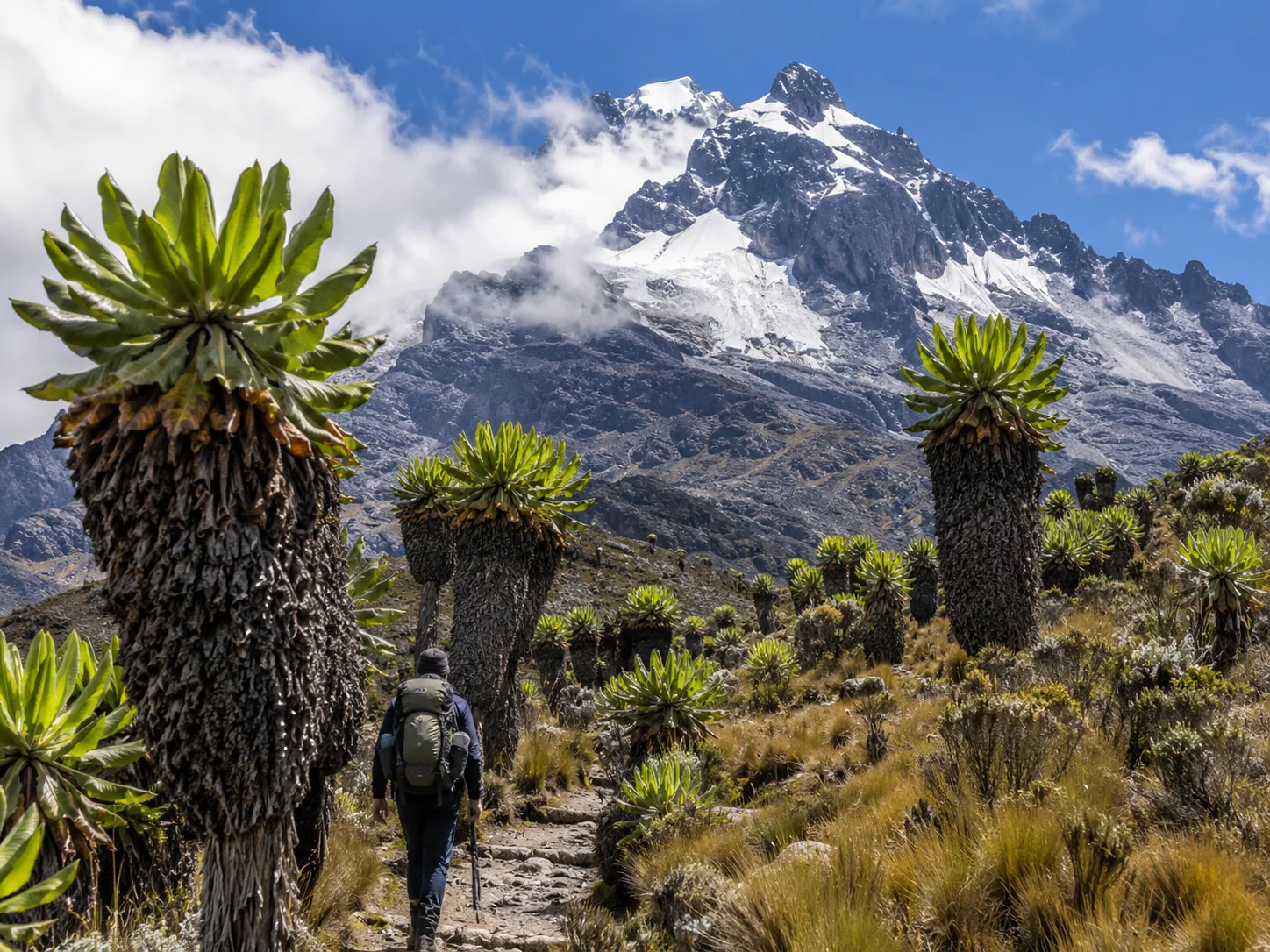
The Kilembe route passes through the Nyamwamba, Kausoni and Nyamugasani river valleys, with waterfalls, deep valleys, giant heather, groundsels and wide mountain views. The hut system gives you staged overnight points before the final push towards the Margherita area. The glacier crossing is normally reached from the Margherita Camp side. For many climbers, the strength of Kilembe is the scenery. You spend more time in open valleys, high ridges and quieter landscapes before the summit attempt. It is demanding, but it gives you a deeper feel of the mountain.
Bukurungu Wilderness Trail
The Bukurungu Trail is for trekkers who want a more remote Rwenzori experience with camping instead of huts. It is known for lakes, waterfalls, rivers, and wild mountain scenery. The trail begins around the Kasanzi and Omukorukumi area and covers roughly 80 km through high lake country. It takes about 8 to 10 days and reaches areas above 4,000 metres around the Bujuku Valley. The route passes 4 beautiful lakes: Mughuli, Bukurungu, Bujuku and Irene. These lakes give the trail its special character, with open mountain camps, quiet valleys and a stronger expedition feel. Unlike the Central Circuit and Kilembe routes, Bukurungu is mainly an open camping trail with no hut system. It suits experienced trekkers who are comfortable with wilderness camping, long walking days and fewer built facilities.
Diamond Trail and Shorter Forest Routes
Not every Rwenzori trek has to reach the glaciers. The Diamond Trail and other lower forest routes work well when you want the Rwenzori atmosphere without a full summit climb. The Diamond Trail starts around Nyakalengija and covers roughly 30 km through lower forest, reaching about 2,500 metres. It takes around 2 to 4 days and suits wildlife lovers, day hikers and those with limited time. These lower routes pass through forest camps, bamboo zones, rivers and birding areas. You still feel the mountain through mist, forest, blue monkeys, birds and thick vegetation, but without the pressure of the high summit routes. Lake Mahoma is another good shorter route from the Nyakalengija side. It starts from the park headquarters area and climbs towards Lake Mahoma, a beautiful glacial lake above Nyabitaba Hut, set within bamboo forest with views towards the higher peaks when the weather opens.
Best Things to See in Rwenzori Mountains National Park
Rwenzori Mountains National Park is not a single-view destination. It changes as you climb. The lower slopes are warm and forested. Higher up, the trail moves into bamboo, heather, bogs, alpine moorland, glacier valleys and snow-covered peaks. That is what makes the Rwenzori different from many mountain parks in East Africa. You do not come here only for one summit photo. You come for the full mountain journey.
Rwenzori Vegetation Zones
One of the strongest attractions in the Rwenzori is the vegetation. The mountain has six clear vegetation zones, and each one gives the trek a different feeling. The lower slopes begin with the savannah zone, followed by the Afromontane forest zone. This is where the mountain feels wet, green and alive, with thick forest, birds, monkeys and shaded trails. Above this comes the bamboo forest zone, then the heather and Rapenea zone. Higher up, the mountain opens into Afro-alpine moorland, one of the most memorable parts of the trek. This is where you walk among giant groundsels, giant lobelias, moss-covered rocks and strange high-altitude plants that look almost prehistoric. Beyond that, the rocky and glacier zone takes over as you climb towards 5,109 metres on Mount Stanley. The giant lobelias and groundsels become more common above 3,800 metres, giving the Rwenzori that wild, ancient character hikers remember long after the trek.
Snow Peaks and Glaciers
The snow peaks are the great symbol of the Rwenzori Mountains. The range sits only a few miles north of the Equator, yet the highest summits still carry snow and glaciers. That contrast is one of the reasons the mountains feel so powerful when you reach the upper zones. The main mountain massifs include Mount Stanley, Mount Speke, Mount Baker, Mount Emin, Mount Gessi and Mount Luigi di Savoia. The highest point is Margherita Peak on Mount Stanley, standing at 5,109 metres. For summit climbers, this is where the trek becomes a serious mountain climb. The air is thinner, the ground is colder, and the final sections involve rock, ice and glacier crossings.
Rwenzori Lakes, Rivers and Waterfalls
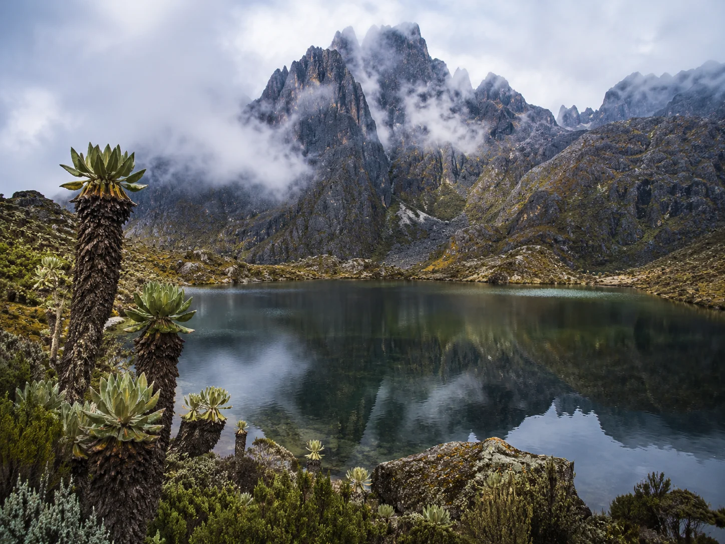
The Rwenzori Mountains hold about 20 lakes, many of them sitting in high valleys shaped by glaciers. Lake Mahoma, at about 2,651 metres, is one of the easier lakes to reach from the Central Circuit side. It gives you a good short-trek option without going deep into the summit zones. Lake Bujuku is one of the most dramatic high-altitude lakes in the park. It sits at the upper end of the glacier-carved Bujuku Valley, below Mount Stanley, Mount Speke and Mount Baker. Reaching this area gives you one of the strongest mountain scenes in the Rwenzori, where water, rock, bogs and peaks meet in one valley. The Nyamwamba Valley on the Kilembe side has a string of 8 lakes formed around glacial moraine and mountain water systems. Rivers and streams begin from these mountains and flow down to support plants, wildlife and farming communities below. That is why the Rwenzori is not only a trekking destination. It is also a water tower for western Uganda.
Wildlife and Primates in Rwenzori Mountains National Park
Wildlife in the Rwenzori is different from what you see in Uganda’s savannah parks. Here, the forest is thick and the slopes are steep, so wildlife reveals itself slowly. You walk, listen, scan the trees and notice movement in the vegetation. The park protects more than 70 mammal species. Along the lower and middle forest trails, you look for black-and-white colobus monkeys, blue monkeys, chimpanzees, tiny antelopes, bushbucks, elephants, buffaloes, golden cats, servaline genets, yellow-backed duikers and giant forest hogs. The Rwenzori otter and leopard also live in this mountain landscape, though they are harder to encounter. The park is also known for unusual reptiles, including the three-horned chameleon. For many hikers, these smaller forest sightings become part of the charm of the mountain.
Bird Watching in the Rwenzori Mountains
Rwenzori Mountains are one of Uganda’s finest high-altitude birding destinations, with 217 bird species. The park is important for Albertine Rift endemics, with around 17 birds closely associated with the Rwenzori and Albertine Rift montane forests. Birding begins around the montane forest zone at about 1,800 metres, where dense canopy and forest trails give you chances to find some of the park’s most sought-after species. Birds to look for include Rwenzori Turaco, Handsome Francolin, Barred Long-tailed Cuckoo, Blue-headed Sunbird, Long-eared Owl, Cinnamon-chested Bee-eater, Rwenzori Batis, Archer’s Robin-chat, White-starred Robin, Montane Sooty Boubou, Lagden’s Bushshrike, Slender-billed Starling, Strange Weaver and Golden-winged Sunbird. You also get greenbuls, barbets, apalises, illadopsis, flycatchers and crimsonwings. Higher up in the alpine zones, the birdlife changes again. Look for Lammergeier, also called the bearded vulture, Black Eagle, Alpine Swift and Scarlet-tufted Malachite Sunbird against the mountain backdrop.
Things to Do in Rwenzori Mountains National Park
Rwenzori Mountains National Park is for those who want more than a quick viewpoint. This is a walking, climbing, birding, and cultural mountain destination. Every activity brings you closer to the real character of the Mountains of the Moon.
Trekking and Mountain Climbing
Trekking is the main experience in the Rwenzori Mountains. To understand this range, you need to walk into it. The trails take you through layer after layer of habitat, starting in the lower forest and climbing into bamboo, tree heathers, bogs, giant lobelias, groundsels and the cold alpine zone near the glaciers. For summit climbers, Margherita Peak on Mount Stanley is the great target. At 5,109 metres, it is Africa’s third-highest peak and the highest point in the Rwenzori Mountains.
A full climb to Margherita takes around 7 to 12 days, depending on route, weather, pace and acclimatisation. The final approach is not just a walk. It involves steep, slippery and uneven ground, snow, ice, glacier sections and exposed rock near the ridge. You need fitness, balance and a good head for heights. The Central Circuit starts around the Mubuku River and climbs towards Nyabitaba Hut before continuing deeper into the mountains. The route passes forest, glacial moraine, Bujuku Valley and high mountain scenery before pushing towards the summit area.
The Kilembe Trail starts from Kilembe near Kasese town on the southern side of the park. It climbs through the Nyamwamba Valley, passing glacial lakes, viewpoints, forest, moorland and high mountain landscapes before joining the upper Rwenzori routes. This route gives good time for acclimatisation and is known for lakes, valleys and glacier views. There are also shorter non-technical treks for those who do not want to summit. You can do day hikes, lower forest walks, foothill trails and shorter climbs towards surrounding peaks and viewpoints. Kasese remains the main gateway town for most Rwenzori treks.
Mount Rwenzori – Hiking Trails & Route Guide
| Route | Duration | Difficulty | Best for | Summit |
|---|---|---|---|---|
| Central Circuit | 6-7 days | High | First Summit attempts | Yes |
| Kilembe Trail | 7-8 days | High | Scenic trekking | Yes |
| Bukurungu | 8-10 days | Very High | Experienced Trekkers | Optional |
| Diamond Trail | 2-4 days | Easy | Short Visits | No |
Hiking and Guided Nature Walks
ot every visit to Rwenzori has to be a summit climb. Guided nature walks are a good way to feel the mountain without committing to a long expedition. These walks take you through lower forest, river valleys, community trails and viewpoints where the mountain opens towards Mount Baker, Portal Peaks and the surrounding foothills. Ruboni and Turaco View are among the community areas for guided forest walks outside and around the park. From these trails, you can follow the River Mubuku, climb to viewpoints at around 2,300 metres above sea level, and look across the lower slopes when the weather clears. On a good day, you can see snow-capped Margherita Peak from selected viewpoints. These walks are also good for birds, chameleons, monkeys and forest scenery. You can see blue monkeys, vervet monkeys, colourful chameleons and forest birds while moving through the lower slopes.
Wildlife Viewing on the Lower Slopes
Rwenzori is not a classic open-grassland wildlife park, so wildlife viewing here feels quieter and more patient. The animals live in thick forest, steep valleys and remote slopes, which makes every sighting feel earned. The park has more than 70 mammal species. Wildlife you can see in and around the mountain includes elephants, giant forest hogs, leopards, bushbucks, golden cats, blue monkeys, Angola colobus monkeys, black-and-white colobus monkeys, chimpanzees, Rwenzori otters and the Rwenzori climbing mouse. One of the special creatures to look for is the three-horned chameleon, a small but memorable species that fits the strange, wet and green character of the mountain.
Cultural Encounters Around Rwenzori
The mountains are not only about peaks and glaciers. The lower slopes are home to local communities whose lives are tied closely to the mountain. Cultural visits around Rwenzori give you time with the people who farm, guide, carry supplies, sing, dance and keep the stories of the mountain alive. Ruboni village is one of the key community areas near the foothills and is home to more than 2,000 Bakonzo people. A visit here gives you a closer look at local life below the mountain, with farming traditions, homestead visits, folk songs, dances and community storytelling. Cultural trails also connect you with the Bakonzo, Bamba and neighbouring communities. Around the Bulemba-Ihandiro cultural trail, you can learn about traditional healing, weaving, fire making, local food preparation, drumming and community history. The Kamusonger River and surrounding foothill landscapes add more depth to the experience.
Gorilla Trekking Add-On After Rwenzori
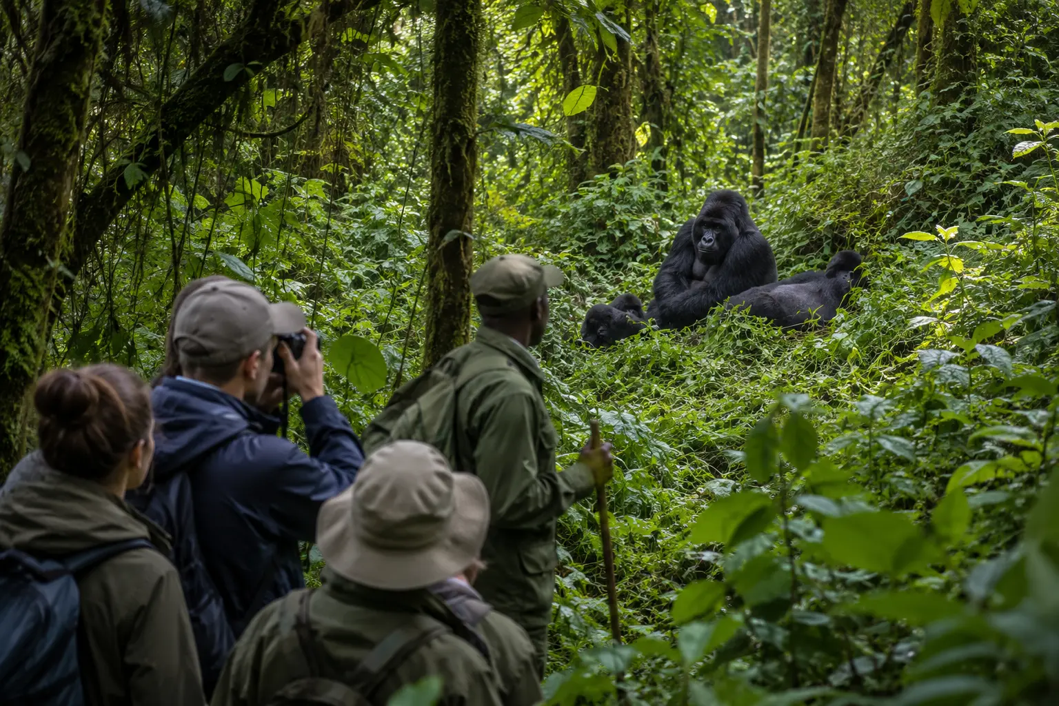
There are no mountain gorillas in Rwenzori Mountains National Park, but we can combine Rwenzori trekking with gorilla trekking in Bwindi Impenetrable National Park. This works well when you want a strong Uganda mountain and primate journey in one itinerary. After climbing or hiking in Rwenzori, gorilla trekking gives you a completely different forest experience. You spend one hour with a habituated gorilla family in its natural mountain forest. For a longer Uganda safari, this combination gives you strong variety: Rwenzori for trekking, glaciers, birds and mountain scenery, then Bwindi for mountain gorillas.
Best Time to Visit Rwenzori Mountains National Park
The best time to visit Rwenzori Mountains National Park is during the drier climbing windows from June to August and December to February. You can hike the Rwenzori Mountains at any time of year, but this is an equatorial alpine range, so you still need to expect mist, cold wind, rain and fast weather changes even in the dry months. The mountain sits close to the Equator, yet the higher slopes are cold, wet and rough, with glaciers, snow, boggy trails and mist-covered peaks shaping the real Rwenzori experience.
Dry Season in Rwenzori Mountains National Park
The dry season is the strongest time for trekking, climbing, birding, photography and summit attempts. The main dry months are June, July and August, followed by another good window from December to February. For climbers aiming for Margherita Peak, the June to August window gives the best climbing conditions, with less rainfall, clearer views and better movement across the higher trails. The trails are still demanding, but the ground is less muddy than in the wet season. This makes it easier to climb towards Mount Stanley, Mount Speke, Mount Baker, Mount Emin and Mount Gessi. The skies also open more, giving you better views of the snow-capped mountains, glaciers, deep valleys and high ridges.
The December to February season is also a good time to climb. After the colder months, the weather becomes more settled, with mild to warm days and cold nights. This period attracts many climbers heading for Margherita Peak, so book guides, accommodation, equipment and permits early. For summit days, the best climbing window is early morning. Climbers heading for the high peaks start very early, around 2:00 am to 8:00 am, because the clearest hours come before heavy cloud builds. The period between 7:00 am and 10:00 am gives better visibility on many days before afternoon mist, wind and thunderstorms form around the peaks.
Wet Season in Rwenzori Mountains National Park
The wet season runs from March to May and again from September to November, with the long rains starting around March and ending in May, and the shorter rainy period building around November. This season brings muddy trails, slippery rocks, cold winds, thick mist and more difficult climbing conditions. The higher summits are regularly covered in cloud, and wet air creates wild rime formations on the glaciers and upper peaks.
For summit climbers, this is a tougher period because the final approaches become more technical, with wet rock, ice, snow and poor visibility. For strong hikers who do not mind mud, cold weather and quiet trails, the wet season still has its rewards. The valleys are greener, waterfalls are stronger, and the lower forest feels alive with birds, monkeys, chameleons and mountain vegetation.
You need proper rain gear, warm layers, waterproof boots, gaiters, gloves and a flexible mindset. For most travellers, June to August and December to February remain the best months. The mountain is never easy, but the right season gives you better trail conditions, clearer summit views and safer movement across the higher slopes.
How to Get to Rwenzori Mountains National Park
Rwenzori Mountains National Park is reached through Kasese, the main gateway town on the western side of Uganda. You can travel by road from Kampala, Entebbe, Fort Portal or Queen Elizabeth National Park, or fly into Kasese Airstrip and continue by road to the park entrance. Your best route depends on your time, budget, trekking route and where your climb starts, whether around Nyakalengija, Ibanda, Kilembe or another trailhead.
By Road to Rwenzori Mountains National Park
The road journey from Kampala to Kasese gives you two main options. The shorter route runs from Kampala through Mubende to Fort Portal, covering about 300 km and taking around 4 hours in good conditions. From Fort Portal, you continue to Kasese, with the final connection taking about 2 to 3 hours by private taxi, bus or arranged transfer.
The longer route runs from Kampala through Masaka, Mbarara and Bushenyi to Kasese, covering about 350 km and taking roughly 6 hours. This route gives you a richer journey across western Uganda, with the chance to stop at the Equator, pass through the cattle country around Mbarara, and connect with Lake Mburo National Park or Queen Elizabeth National Park before continuing to Kasese. The main roads to Kasese are fairly tarmacked and in good condition.
Fuel is easy to find along the way. A 4×4 vehicle is still the best choice for comfort, ground clearance and flexibility, mainly when continuing to mountain trailheads, community areas or lodge roads close to the park. From Kasese town to the park entrance, the transfer takes about 30 to 40 minutes, depending on your trailhead. You can use a private taxi, lodge transfer or boda-boda for short local movements, though a vehicle is better when carrying trekking bags, boots and mountain gear. Once you reach the park entrance, you register, meet your guides and porters, confirm permits and prepare for the trek.
By Air to Rwenzori Mountains National Park
Flying is the fastest way to reach Rwenzori Mountains National Park when you want to save time before or after a climb. Chartered or scheduled flights operate from Entebbe International Airport to Kasese Airstrip, with the flight taking about 30 minutes. From Kasese Airstrip, it is around 40 minutes by road to the park area, depending on your lodge, briefing point and trekking route.
Flights to Kasese work well if you have limited time, want to avoid a long road transfer before starting the mountain, or want to combine Rwenzori with other Uganda safari destinations. Some flights operate in two daily schedules, with departures around 7:00 am and 12:00 noon, subject to aircraft availability, weather, and booking arrangements.
After landing at Kasese Airstrip, arrange your transfer in advance. The Rwenzori routes begin from different access points, so you do not want to arrive with heavy trekking gear and start looking for transport on the spot. Confirm your airstrip pickup, lodge, park registration time, trekking permits, porter arrangements, and route briefing before flying.
Where to Stay in Rwenzori Mountains National Park
Where you stay depends on your trekking route, how close you want to be to the trailhead, and whether you want a simple climber’s base, community camp, town hotel or mountain hut inside the route. For Central Circuit treks, Nyakalengija, Ibanda and Ruboni are the most convenient bases. For the Kilembe Trail, Kyanjuki and Kilembe place you closer to the Nyamwamba Valley route. Kasese town works well when you want easier access to shops, transport and extra comfort before or after the mountains.